
See more than traffic. See safety.
Try SaferTravels at GetSaferTravels.com.
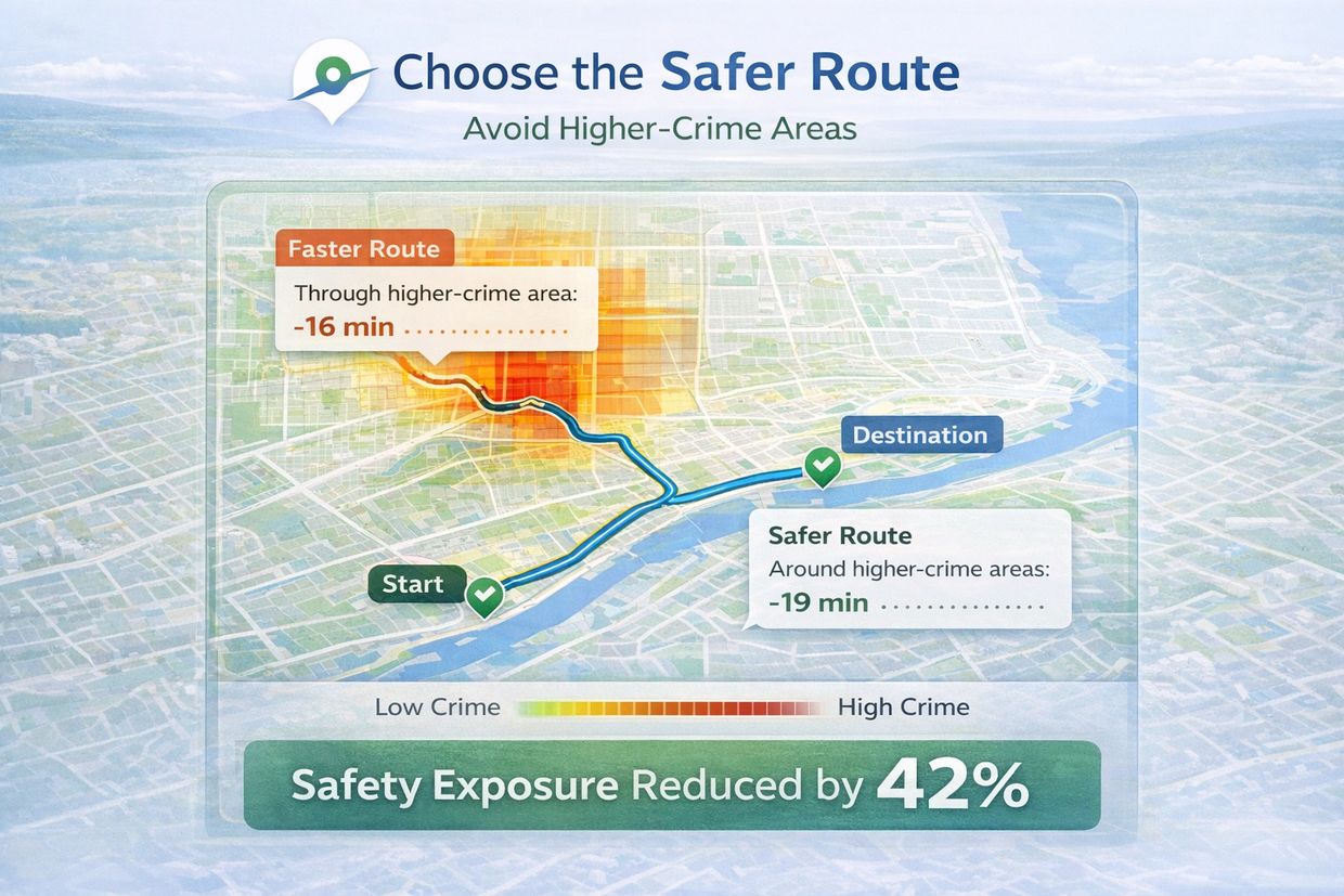
SaferTravels helps travelers navigate unfamiliar cities with confidence and peace of mind. Visualize crime density and choose routes that may reduce exposure to higher-risk areas.

Share Safer Routes with the People You Care About
SaferTravels allows you to map and share routes that reduce exposure to higher-incident areas.
Send safer routes to family, friends, or teenage drivers with a single link.
Navigation Designed for Awareness, Not Fear
SaferTravels is an informational tool intended to support situational awareness.
It does not predict crime or guarantee safety.
Our goal is to help travelers make more informed navigation choices.
Thank you for visiting SaferTravels!
